

The warnings include one - at Collingham - which states 'immediate action is required'. Here are the locations and information for each warning (information correct 7.30am Jan 20):
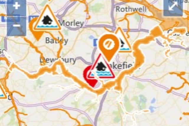
1. Lower River Calder catchment
River levels are forecast to continue to remain elevated across the Lower River Calder Catchment as a result of persistent rainfall. Further rainfall is expected throughout today (20/01/2021) which will elevate river levels further. Consequently, flooding of property, roads and farmland is possible. Areas most at risk are low lying land, roads and farmland. Our field teams have checked defences and cleared screens ahead of the rainfall and we are liaising closely with our partners to ensure they are ready to respond. Please put your flood plan into action and activate any property flood protection products you may have, such as flood barriers and air brick covers. Avoid using low lying footpaths near watercourses and plan driving routes to avoid roads which may be flooded. This message will be updated by 12:30pm, 20/01/2021, or as the situation changes. Photo: Gov
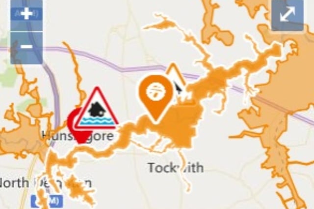
2. Lower River Nidd catchment
The flood alert for the Lower River Nidd and its tributaries including Sand Beck, Sike Beck, Pool Beck and Great Gutter remains in force. Flooding of low-lying land and roads is possible overnight and into Wednesday, 20/01/2021. The river has risen in response to recent rainfall, and with persistent and heavy rain forecast to continue through until Thursday 21/01/2021, we expect river levels to remain high and could rise further. See the GOV.UK website for a 5 day flood forecast and river levels. Please avoid low-lying land and footpaths near local watercourses. We are closely monitoring the situation and will update this message in 8 hours or as the situation changes. Photo: Gov
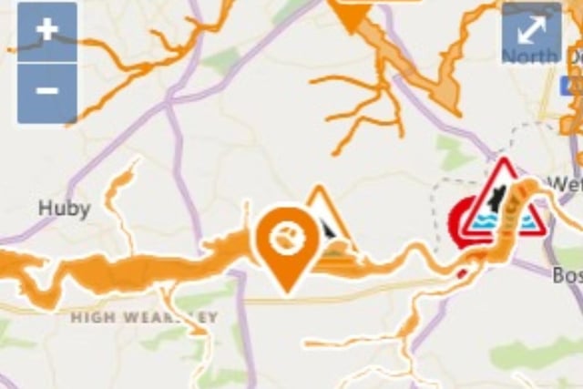
3. Lower River Wharfe
The flood alert for the lower River Wharfe remains in force. Flooding of low-lying land and roads is possible overnight and into Wednesday 20/01/2021. The River Wharfe is rising in response to recent rainfall. Levels in Ilkley and Otley are currently expected to peak at a lower level than was seen in November 2020, at around 6am on Wednesday 20/01/2021. Levels could rise in Wetherby and Tadcaster until Wednesday afternoon or evening. Persistent and heavy rain is forecast to continue through until Thursday 21/01/2021, and river levels could remain high through the week. See the GOV.UK website for a 5 day flood forecast and river levels. Please avoid low-lying land and footpaths near local watercourses. We are closely monitoring the situation and will update this message on Wednesday morning, 20/01/2021 or as the situation changes. Photo: Gov
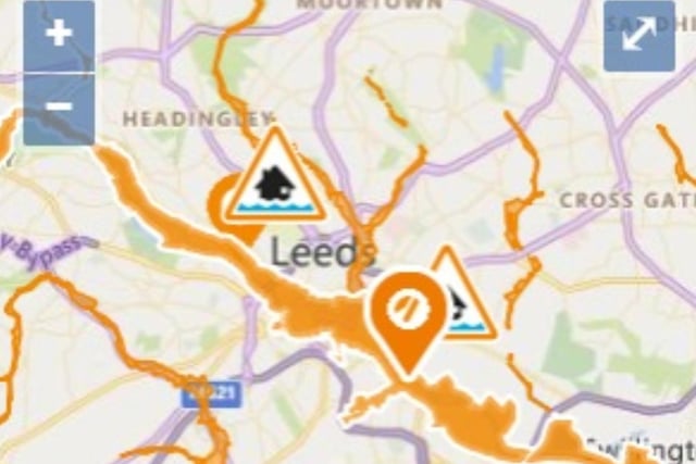
4. Middle River Aire catchment
River levels are forecast to continue to remain elevated across the Middle River Aire Catchment as a result of persistent rainfall. Further rainfall is expected throughout today (20/01/2021) which will elevate river levels further. Consequently, flooding of property, roads and farmland is possible. Areas most at risk are low lying land, roads and farmland. Our field teams have checked defences and cleared screens ahead of the rainfall and we are liaising closely with our partners to ensure they are ready to respond. Please put your flood plan into action and activate any property flood protection products you may have, such as flood barriers and air brick covers. Avoid using low lying footpaths near watercourses and plan driving routes to avoid roads which may be flooded. This message will be updated by 10:30am, 20/01/21, or as the situation changes. Photo: Gov